SEC A / DESIGN & PRE-CONSTRUCTION
Topographic survey in Bali
Almost every expensive surprise on a Bali build traces back to land nobody measured properly: the two-metre fall the listing photos hid, the fence that sits a metre inside the certificate line, the drain crossing the plot exactly where the pool was going. A topographic survey answers all of it in one visit — precise levels, true boundaries, existing services and every tree worth keeping, delivered as drawings your designer can actually use.
- Total station plus drone in one visit
- Boundary check against your land certificate
- Layered DWG and PDF delivered within a week
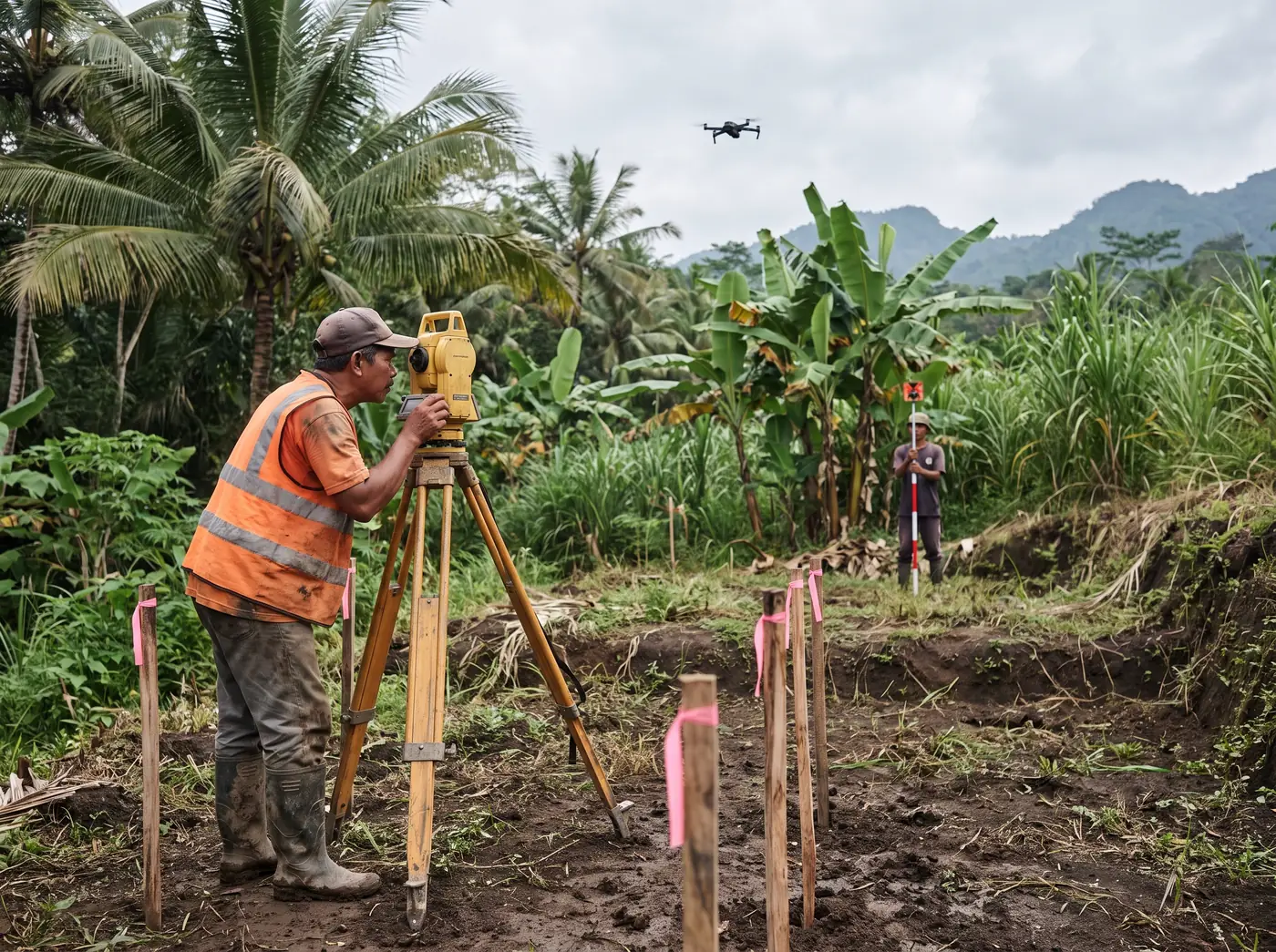
We survey with a total station for control points, levels and boundary work, then fly a drone for dense surface data and a current orthophoto of the whole plot. Both datasets are tied to fixed benchmarks, so everyone — designer, engineer, contractor — works from one coordinate system. On sloped land we tighten the measurement grid, because a contour interval that flatters a hillside above Bingin can hide a retaining wall costing hundreds of millions of rupiah.
You receive a layered DWG plus printable PDFs: contours at 0.25–0.5 m intervals, spot levels, boundary lines overlaid on the certificate geometry, utilities, access and a numbered tree schedule. If pegs and paper disagree, you'll know before you design — not after the neighbour does. And when construction starts, the same control points let us set the building out exactly where the drawings say it should stand.
Why Bali plots need more than a sketch
Bali land is rarely flat and almost never matches its paperwork exactly. Former rice terraces step down in metre-high benches that read as 'gently sloping' in listings. Certificate geometry drawn decades ago gets re-fenced by each new owner, and subak irrigation channels cross private plots with usage rights no certificate mentions. Design on assumptions and the corrections arrive later as change orders: extra retaining, imported fill, a relocated pool.
Levels drive money here more than anywhere, because every cubic metre of cut or fill is a truck on a narrow lane. A survey that fixes the ground model early lets your designer balance earthworks across the plot, set floor levels above the wet-season runoff path — the one that appears during 80–100 mm/hr cloudbursts — and place the driveway where the gradient actually allows one. The survey usually costs a tenth of a single misplaced retaining wall.
From survey to setting-out
A survey earns its keep twice. First at design stage, when contours, sections and the boundary overlay replace guesswork. Then again when construction starts: the benchmarks we placed become the control for setting-out, so column grids, boundary offsets and finished floor levels land within tolerance of the drawings. We return with the total station to peg the building, check formwork positions and certify levels before concrete pours.
Owners who bought land years ago use the same service defensively — a re-survey before selling, subdividing or fencing settles boundary questions with data instead of arguments. Where a dispute already exists, a measured drawing comparing occupation lines against certificate geometry is the document every mediator asks for first.
SCOPE OF WORK
What's included
Control network & benchmarks
Permanent reference points established on site, so design and construction share one coordinate system.
Total-station survey
Levels, boundaries, structures and hard detail measured point by point to centimetre accuracy.
Drone photogrammetry
High-overlap flight producing a dense surface model and a current orthophoto of the whole plot.
Boundary verification
Field pegs and fences compared against the certificate geometry, with discrepancies flagged in writing.
Utilities & vegetation mapping
Visible services, drains, poles and access routes, plus a numbered schedule of significant trees.
CAD deliverables
Layered DWG, PDF sheets and the point data on request — formatted for designers, not just for filing.
PROCESS
How the job runs
- 01
Scope & desk check
We review your certificate, site photos and design intent, then fix scope, grid density and price.
- 02
Field survey
Total-station control and boundary work plus a drone flight — most plots are measured in a single day.
- 03
Processing & drafting
Point data and photogrammetry merged, checked and drafted into a layered DWG with PDF sheets.
- 04
Delivery & walkthrough
We hand over the deliverables, talk you through findings and flag any boundary discrepancy in writing.
INDICATIVE PRICING
Honest numbers, before the survey
| Scope | Guide price |
|---|---|
| Topographic survey, plot up to 1,000 m² | from IDR 4,500,000 |
| Each additional are (100 m²) | from IDR 350,000 |
| Construction setting-out | from IDR 3,500,000 / visit |
Terrain and vegetation set the final figure — fixed after a free desk review of your certificate and site access.
Request an exact quoteFAQ
Topographic surveys in Bali — what owners ask
How long does a survey take?
Fieldwork on a typical plot up to 1,000 m² is one day; drafting and checks take two to three more, so most clients hold finished DWG and PDF files within a week. Steep or heavily vegetated sites can add a field day — we confirm the schedule before booking, inside the fixed quote.
Can you confirm my boundaries match the certificate?
We overlay the certificate geometry onto the measured survey and show exactly where fences and pegs sit relative to it, with distances marked. That tells you whether there's a problem and how big it is. Formal boundary re-establishment is a licensed cadastral process through the land office, and we coordinate with it when needed.
Do I need a survey for a flat plot?
Yes, though it costs less. Visually flat land routinely hides half a metre of fall, and drainage design lives or dies on those numbers when rain arrives at 80–100 mm per hour. You also get the boundary check, utilities and tree positions — the items that quietly reshape layouts once a designer sees them.
What does a topographic survey cost in Bali?
Plots up to 1,000 m² run from IDR 4,500,000 complete, with each additional are (100 m²) from IDR 350,000 depending on terrain and vegetation. Setting-out visits during construction are from IDR 3,500,000 each. Every job is quoted fixed after a free desk review of your certificate and access.
RELATED SERVICES
Often booked together
FROM THE BLOG